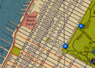
This map shows the area as it was in 1939.

In contrast, this map shows the same area in 1990, when, as you can see, instead of individual streets, the area is made up of squares that include various streets that were once separate.Similarly, the aerial views also changed greatly.

Above is an aerial view of the future Lincoln Center site in 1955.

This is a more recent aerial view of the same blocks.
No comments:
Post a Comment